Luxor
| Luxor الأقصر al-Uqṣur |
|
|---|---|
 |
|
 Luxor
|
|
| Coordinates: | |
| Country | |
| Governorate | Luxor Governorate |
| Area[1] | |
| - Total | 416 km2 (160.6 sq mi) |
| Population (1999)[1] | |
| - Total | 376,022 |
| Website | www.luxor.gov.eg |
Luxor (in Arabic: الأقصر al-Uqṣur) is a city in Upper (southern) Egypt and the capital of Luxor Governorate. The population numbers 376,022 (1999 survey), with an area of approximately 416 square kilometres (161 sq mi) [1]. As the site of the Ancient Egyptan city of Thebes, Luxor has frequently been characterized as the "world's greatest open air museum", as the ruins of the temple complexes at Karnak and Luxor stand within the modern city. Immediately opposite, across the River Nile, lie the monuments, temples and tombs on the West Bank Necropolis, which include the Valley of the Kings and Valley of the Queens. Thousands of international tourists arrive annually to visit these monuments, contributing a large part towards the economy for the modern city.
Contents |
History
For the ancient settlement of Luxor, see Thebes, Egypt
Luxor was the ancient city of Thebes, the great capital of Egypt during the New Kingdom, and the glorious city of the god Amon-Ra. The city was regarded in the Ancient Egyptian texts as w3s.t (approximate pronunciation: "Waset"), which meant or "city of the sceptre" and also as t3 ip3t (probably pronounced as "ta ipet" and meaning "the shrine") and then, in a later period, the Greeks called it Thebai and the Romans after them Thebae. Thebes was also known as "the city of the 100 gates", sometimes being called "southern Heliopolis" ('Iunu-shemaa' in Ancient Egyptian), to distinguish it from the city of Iunu or Heliopolis, the main place of worship for the god Ra in the north. It was also often referred to as niw.t, which simply means "city", and was one of only three cities in Egypt for which this noun was used (the other two were Memphis and Heliopolis); it was also called niw.t rst, "southern city", as the southernmost of them.
The importance of the city started as early as the 11th Dynasty, when the town grew into a thriving city, renowned for its high social status and luxury, but also as a center for wisdom, art, religious and political supremacy.[2] Montuhotep II who united Egypt after the troubles of the first intermediate period brought stability to the lands as the city grew in stature. The Pharaohs of the New Kingdom in their expeditions to Kush, in today's northern Sudan, and to the lands of Canaan, Phoenicia and Syria saw the city accumulate great wealth and rose to prominence, even on a world scale.[2] Thebes played a major role in expelling the invading forces of the Hyksos from Upper Egypt, and from the time of the 18th Dynasty through to the 20th Dynasty, the city had risen as the major political, religious and military capital of Ancient Egypt.
The city attracted peoples such as the Babylonians, the Mitanni, the Hittites of Anatolia (modern-day Turkey), the Canaanites of Ugarit, the Phoenicians of Byblos and Tyre, the Minoans from the island of Crete.[2] A Hittite prince from Anatolia even came to marry with the widow of Tutankhamun, Ankhesenamun.[2] The political and military importance of the city, however, faded during the Late Period, with Thebes being replaced as political capital by several cities in Northern Egypt, such as Bubastis, Sais and finally Alexandria.
However, as the city of the god Amon-Ra, Thebes remained the religious capital of Egypt until the Greek period.[2] The main god of the city was Amon, who was worshipped together with his wife, the Goddess Mut, and their son Khonsu, the God of the moon. With the rise of Thebes as the foremost city of Egypt, the local god Amon rose in importance as well and became linked to the sun god Ra, thus creating the new 'king of gods' Amon-Ra. His great temple, at Karnak just north of Thebes, was the most important temple of Egypt right until the end of antiquity.
Later, the city was attacked by Assyrian emperor Assurbanipal who installed the Libyan prince on the throne, Psammetichus.[2] The city of Thebes was in ruins and fell in significance. However, Alexander the Great did arrive at the temple of Amun, where the statue of the god was transferred from Karnak during the Opet Festival, the great religious feast.[2] The grandeur of Thebes would still remain a site of spirituality, and attracted numerous Christian monks in the Roman Empire who established monasteries amidst several ancient monuments including the temple of Hatshepsut, now called Deir el-Bahri ("the northern monastery").[2]
Climate
| Climate data for Luxor | |||||||||||||
|---|---|---|---|---|---|---|---|---|---|---|---|---|---|
| Month | Jan | Feb | Mar | Apr | May | Jun | Jul | Aug | Sep | Oct | Nov | Dec | Year |
| Source: Climate Charts[3] | |||||||||||||
Rainfall in Luxor is rare. The city can get between 0.0 to 6.0 millimeters of rain per month. Average annual rainfall is 0.1 inches per year (2.3 mm).
During the summer months, the temperature can easily reach 50 celsius. In the neighboring Valley of the Kings, temperatures have been known to reach 57 degrees centigrade. Luxor is slightly cooled off by the Nile which runs alongside.
Economy

The economy of Luxor, like that of many other Egyptian cities, is heavily dependent upon tourism. Large numbers of people also work in agriculture, particularly sugarcane. The city is notably poorer than Cairo and poverty is widespread in Luxor.
To make up for shortfalls of income, many cultivate their own food. Goat's cheese, pidgeons, subsidised bread and home-grown tomatoes are commonplace among the majority of its residents.
Infrastructure
Transport
Luxor is served by Luxor International Airport.
A bridge was opened in 1998, a few kilometres upstream of the main town of Luxor, allowing ready land access from the east bank to the west bank.
Traditionally, however, river crossings have been the domain of several ferry services. The so-called 'local ferry' (also known as the 'National Ferry') continues to operate from a landing opposite the Temple of Luxor. The single fare (June 2008) is 1 L.E. - one Egyptian Pound - per passenger for foreigners. Egyptian nationals pay ¼ of that, 25 piasters. This ferry is mainly used by the locals although a number of foreigners do use it. The sites on the west bank are further than you think and you will need transport - taxi drivers often approach ferry passengers, and it is recommended that a fare be negotiated ahead of time. There are also local cars that reach some of the monuments for 25 piasters, although tourists rarely use them. Alternatively, motorboats line the bast bank of the Nile all day providing a quicker, but more expensive (5 L.E.), crossing to the other side.
The city of Luxor on the east bank has several bus routes used mainly by locals. Tourists often rely on horse carriages, called "calèches," for transport or tours around the city. Do not ask calèche drivers to go to the west bank, because it is too far for the horses, not to mention illegal. Taxis are plentiful, and reasonably priced, and since the government has decreed that taxis older than 20 years will not be relicensed, there are many modern air-conditioned cabs. Recently, new roads have been built in the city to cope with the growth in traffic.
For domestic travel along the route of the Nile, a rail service operates several times a day. A morning train and sleeping train can be taken from the railway station situated around 400 metres (440 yd) from Luxor Temple. The line runs between several major destinations, including Cairo to the north and Aswan to the south.
Sights of modern-day Luxor
- East bank
- Luxor Temple
- Luxor International Airport
- Karnak Temple
- Luxor Museum
- Mummification Museum
- Winter Palace Hotel
- West bank
- Valley of the Kings
- Valley of the Queens
- Medinet Habu (memorial temple of Ramesses III)
- The Ramesseum (memorial temple of Ramesses II)
- Deir el-Medina (workers' village)
- Tombs of the Nobles
- Deir el-Bahri (Mortuary Temple of Hatshepsut, etc.)
- Malkata (palace of Amenophis III)
- Colossi of Memnon (memorial temple of Amenophis III)
International relations
Twin towns — Sister cities
Luxor is twinned with:
Gallery
 Hot-air ballooning over the west bank |
.jpg) Street market in Luxor |
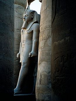
 Pharaonic statue in Luxor Temple |
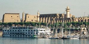
 Panoramic view of Luxor |
See also
- Aswan
- List of megalithic sites
References
- ↑ 1.0 1.1 1.2 luxor.gov.eg
- ↑ 2.0 2.1 2.2 2.3 2.4 2.5 2.6 2.7 "History of Luxor (Thebes)". Sacred Destinations. http://www.sacred-destinations.com/egypt/luxor-history.htm. Retrieved December 1, 2008.
- ↑ "Luxor, Egypt: Climate, Global Warming, and Daylight Charts and Data". Climate Charts. http://www.climate-charts.com/Locations/u/UB62405.php. Retrieved September 26, 2009.
- ↑ "Baltimore City Mayor's Office of International and Immigrant Affairs - Sister Cities Program". http://www.baltimorecity.gov/government/intl/sistercities.php. Retrieved 2009-07-18.
External links
- Theban Mapping Project: website devoted to the Valley of the Kings and other sites in the Theban Necropolis
- Luxor World Heritage Site in panographies - 360 degree interactive imaging
- Kamil, Jill (November, 2008). "The Development Plan for Luxor". Al-Ahram Weekly, Issue No. 921. http://weekly.ahram.org.eg/2008/921/heritage.htm.
- Luxor Temple picture gallery at Remains.se
|
|||||
|
||||||||||
|
|||||||

